Skip to main content
Home
Explore
Explore
Author Profiles
Selkirk Innovates
About
FAQs
Guidelines
Copyright
Formats & Sizes
File Naming
Submit Content
Submission Agreement
Contact
Search terms
Select Collection
All Top Level Collections
FWW Students
Student Work
King Collection
Selkirk Innovates
Harry Pepper Fonds
Additional Manuscripts Fonds
Selkirk College Collection
Mason Collection
SEG Faculty
HHS Students
Pictin/Scott Slide Collection
Faculty Publications
Selkirk College Archives
Archival Maps and Plans
UAS Students
SEG Students
School of Environment & Geomatics
HHS Faculty
School of Health & Human Services
Local Newspapers
Arca Appearance
Minto Files
UAS Faculty
Selkirk College Fonds
Industry & Trades
Photographs
Archival Photographs
Mir Website Archive
Mir Centre for Peace Collection
Artifacts
Selkirk College Documents
University Arts & Sciences
Doukhobor Collection
Migration stub
Selkirk College Calendars
DANM Students
Local Indigenous Collection
Black Bear Review
Search
DGI Header Menu
Home
Explore
About
Contact
Columbia Basin Watershed Network
Friends of the Lardeau River GIS & Mapping Support Project - Forest Cover Map
Friends of the Lardeau River GIS & Mapping Support Project - Forest Activity & General Forest Ownership Map
Friends of the Lardeau River GIS & Mapping Support Project - A Map of the Biogeoclimatic Ecosystem Zones
Friends of the Lardeau River GIS & Mapping Support Project - Fish Habitat Values Map
Friends of the Lardeau River GIS & Mapping Support Project - Wildlife Habitat Values Map
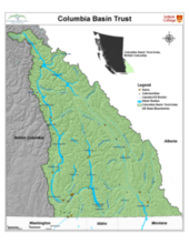
CBT Columbia River Watershed Simple Poster
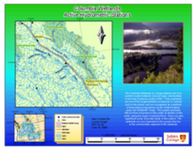
Friends of the Lardeau River GIS & Mapping Support Project - The Lardeau River Watershed (low resolution version)
Friends of the Lardeau River GIS & Mapping Support Project - A Simple Map of the Lardeau Watershed
SHIM Mapping of Murphy, Hanna, & Topping Creeks, Rossland BC (Rossland Water Stewardship Task Force)
CBT Water Quality Monitoring Map
Jimsmith Lake Watershed (Jimsmith Lake Community Association) - Wildlife Values & Non-Sensitive Endangered Plant and Animal Species
Lake Lillian (Toby Benches Society) - Andreen, Wilmer, & Neave Creek Watershed Features
Jimsmith Lake Watershed (Jimsmith Lake Community Association) - Angus and East Angus Creek Survey
Jimsmith Lake Watershed (Jimsmith Lake Community Association) - Forest Coverage and Activities
Jimsmith Lake Watershed (Jimsmith Lake Community Association) - Jimsmith Lake Watershed Features
Slocan Lake (Slocan Lake Stewardship Society) - Slocan Lake Hydrologic Features
Columbia Wetlands (Columbia Wetlands Stewardship Partners) - Columbia Wetlands Active Hydrometric Stations
Salmo River (Salmo Streamskeepers Society) - Watershed Impacts
Salmo River (Salmo Streamskeepers Society) - Salmo River Watershed
Rossland Streamkeepers
Pagination
First page
« First
Previous page
‹‹
Page
1
Page
2
Page
3
Page
4
Page
5
Page
6
Current page
7
Page
8
Page
9
Next page
››
Last page
Last »